Sallows and Sour Howes
TWO Wainwright circular walk: Sour Howes, Sallows
Walk Rating:⭐⭐
Time: 2 - 3 hours
Parking: roadside on the Moorhowe Road, at the end of Dubbs Road (free)
 |
| Sallows (viewed from an alternative route from Ings) |
Sallows and Sour Howes are two low fells to the south of the main Lakeland peaks that Wainwright thought still merited inclusion in the Far Eastern Fells Walking Guide. They aren't fells of particular note although a walk to one or both, as they are connected by a grassy ridge, is a pleasant enough way to stretch your legs, taking in views over Windermere and beyond.
There are various routes you could take, for example starting from Kentmere or Ings, but the route I have described starts from the Moorhowe Road, the minor road running from Ings to Troutbeck. This starting point provides a good chance of finding a roadside parking place, although with some competition from dog walkers and others looking for a stroll on the fells!
 |
| Strava estimates a walking distance of around 12km |
 |
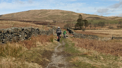
| Follow the sign at the start of the walk |
 |
| Sour Howes in the distance as you start up the Dubbs Road |
2. After the reservoir, the track continues until, just before a wood of conifers, above the cabins of the Limefitt Holiday Park, a tall ladder stile goes over the wall on your right. Cross the stile and go up and right to a rocky knoll, on a path cut into the turf. There's a good view back over the valley to Wansfell.
 |
| Cross the wall to your right at this stile |
3. Now head on up through the bracken and grass towards the rocky outcrops on the ridge above you. The path climbs quite steeply (and muddily too!) at times over a series of hummocks and knolls, known as Applethwaite Common, up towards the top of Sour Howes. Windermere will be behind you as you climb.

 |
| Climb upwards across the hummocks and knolls |
4. You will eventually reach a wooden stile across another stone wall and, then, ahead of you, lie the various grassy mounds that make up the top of Sour Howes. One hump that, by the worn path to its top, appears to be regarded as the summit, may (or may not!) have a small pile of stones marking its top.
 |
| Cross over this stile near to the top of Sour Howes |
 |
| Windermere from the top of Sour Howes |
4. To reach Sallows, head north along a muddy path that, at first, goes on over some more grassy hummocks.
 |
| The path on towards Sallows heading on to the top-left |
5. The path then descends slightly to meet the stone wall that curves along the top of the ridge leading to Sallows.
 |
| Follow the wall along the ridge to Sallows |
6. The path skirts along the left side of the wall until you reach a stile that allows you to cross the wall and walk up to the top of Sallows. A mound of grass and shale marks its highest point. There are good views west towards the Coniston Fells.
 |
| Looking west from the top of Sallows |
7. Returning back down towards the ridge wall, and the way back to Sour Howes, keep over to the right for a good view north-west across to Red Screes.
 |
| Looking over to Red Screes |
8. Once you have retraced your muddy steps back to the hummocks of Sour Howes, you could return the way you came up. However, for some variety, instead head south across the grass (rather than on the path that keeps to higher ground and ends up at a stand of trees). Head down towards a stream running alongside the stone wall that is continuing downhill from the wooden stile that you crossed on the way up from the Dubbs Road. Walk down the slope aiming for the 'T-junction' of stone walls below, at the foot of the streambed.
 |
| Aim for the T-junction in the walls at the foot of this streambed |
9. Cross the line of the wall just to the left of the 'T-junction' then skirt right to contour along the wall until you reach a fence. Cross the fence, trying to keep your boots dry in some boggy ground, then head left and downhill. Dubbs Reservoir will appear down to your right. Head onwards towards some trees and another small reservoir ahead of you.
 |
| Heading down to High Borrans |
7. After a gate, the path becomes a wider track heading down to the left side of a wooded area which comes out at a gate onto the road, next to the High Borrans Outdoor Education Centre. Turn right and walk along the tarmac of Borrans Lane for just over a kilometre, until you reach the junction with Moorhowe Road. Turn right to complete the circuit along this road. There are unexpected views over towards the high fells to your left, before you return to the end of Dubbs Road.
 |
| Looking over towards Langdale and Scafell Pikes |
Worth knowing: It's good to see that High Borrans, owned by North Tyneside Council, seems to have so far survived the cuts that have seen some councils cease funding to other outdoor education centres. These centres offer valuable opportunities to young people from urban areas to experience the open spaces of national parks such as the Lake District.
 |

