Raven Crag
ONE Wainwright walk: Raven Crag
Walk Rating:⭐⭐
Time: 2 hours
Parking: at Legburthwaite - some free places available near the junction at the main road or paid parking in the village.
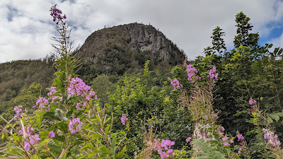 |
| Raven Crag with summer flowers |
There are numerous 'Raven Crags' on the fells of Lakeland but this small peak overlooking Thirlmere is the one that makes it into the Wainwright Guides as a summit in its own right.
A climb to the top of the crag feels more like a woodland walk than a Lakeland hike but is rewarded by a fine view over Thirlmere. Visits to the site of an old hill fort, and the far more modern Thirlmere Dam, provide additional interest to the route described below.
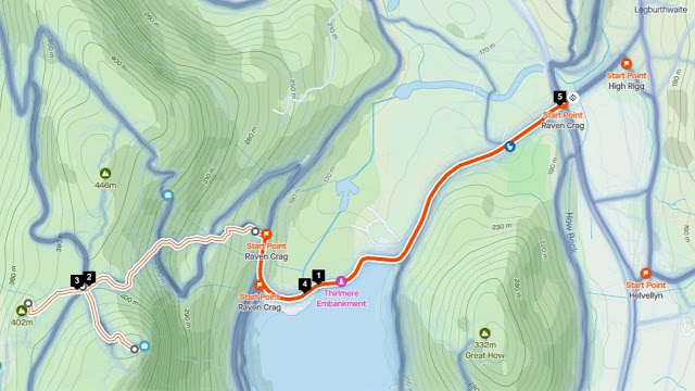 |
| Strava estimates a walking distance of 5km |
1. Cross the A591 carefully and walk along the Dam Road, past a campsite. Raven Crag comes into view over the fields beyond the farm.
 |
| Raven Crag will come into view across the fields |
2. Now walk across the Thirlmere Dam. There are barriers preventing cars from doing the same.
 |
| Walk across the Thirlmere Dam |
3. The road climbs slightly to a junction with the road that goes around the far side of the reservoir. This is also a place where cars can park. Turn right along the road and then, where signposted, leave the road and walk up the slope to your left.
 |
| Thirlmere from the junction of the reservoir roads |
4. The clear path climbs through trees, crossing a forest road and then, when it again meets the forest road as it loops back around, head straight across and upwards through cleared ground, with Raven Crag above you.
 |
| Walk up to the ridge below Raven Crag |
5. The path climbs to the ridge to the north of Raven Crag. Turn left and follow the path, even equipped with steps that wouldn't look out of place in a nature trail (!), up through the trees and bilberries to the summit (1512'). There is a viewing platform on the top of the crag but even better views over Thirlmere can be found if you tread carefully off the path to the south as well.
 |
| Thirlmere from the top of Raven Crag |
6. When you return to the top of the ridge on your way down, it's worth taking a detour to your left where, passing through a fence, you will soon reach a rocky promontory overlooking the valley of Shoulthwaite Gill. This is the site of Castle Crag (or Shoulthwaite) Hill Fort, which is "possibly post-Roman in date".
 |
| The hillfort overlooking Shoulthwaite Gill |
7. Now return to the ridge and walk back to Thirlmere Dam via the original route.
Worth knowing: The Thirlmere Dam was constructed at the end of the nineteenth century to provide water for the growing population and industry of Manchester. It allowed for water to be transported the 96 miles to the city by gravity flow alone.
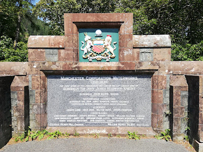 |
| The 1890 commemoration stone on the Thirlmere Dam |
The villages of Armboth and Wythburn were submerged as the water levels rose behind the dam. The only building that survived was Wythburn Church, still standing at the side of Thirlmere and a popular starting place for one of the gentler routes to the top of Helvellyn.
 |
| Thirlmere seen from the walk above Wythburn Church |

