Grange Fell & Great Crag
TWO Wainwright circular walk: Grange Fell and Great Crag
Walk Rating:⭐⭐⭐
Time: 2 - 3 hours
Parking: in the National Trust Car Park in Watendlath (£6.50 for 4 hours in 2021)
 |
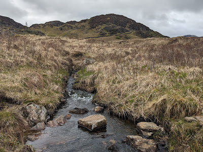
| King's How and Brund Fell from below Rosthwaite Fell |
Wainwright was clearly fond of Grange Fell. It is certainly not amongst the highest or most dramatic of fells but covers an interesting area of heathery slopes and varied summits, offering a range of views.
Grange Fell's accepted "summit" of Brund Fell isn't even its actual highest point, which is the less interesting Ether Knott, to the north of the fell. But its best-known top is a third height, that of King's How, which provides a good view north over Derwent Water.
It's neighbour, Great Crag, covers similar territory. The two fells are easily combined with a circular walk that includes both the King's How and Brund Fell tops. A hike can be started from Rosthwaite, to the west, or, as I have described below, from Watendlath, to the east.
 |
| Strava estimates a walking distance of 8 km |
1. Start by crossing the old stone bridge over the beck at the end of Watendlath Tarn. At the signpost soon after the bridge, it's a nicer walk if you head right, away from the tarn, and walk up through the grass, through a gate, and then make your way up the hillside on a path to the left of a stone wall.
 |
| The bridge over the beck at Watendlath |
2. Follow the path up to the rocky summit of Brund Fell (1363').
 |
| Looking south-west, towards Borrowdale |
3. There are various rocky tors to choose from, the highest of which may, or may not, have a small cairn.
 |
| Looking north, towards Skiddaw |
4. To make your way to King's How, look for the path heading west, between the rocks and hummocks, in the direction of Castle Crag and Dale Head.
 |
| Take this path west towards Castle Crag |
5. Descend slightly from the top of Brund Fell, then look for the path heading right, down into a hollow, heading towards King's How.
 |
| Head right towards King's How |
6. Use the ladder stile to cross the wall in the hollow and then continue onwards.
 |
| Cross the stile over the stone wall |
7. The path reaches a broken fence in a damp hollow. After wet weather, the stepping stones in the grass will be of more use to you than the stile!
 |
| Choose one of the two paths to the top of King's How |
8. You can now climb to the top of King's How, either on a steeper path to the right, or a more clearly marked path to the left.
 |
| The final pitch up to King's How (on the clearer path) |
9. The bare rounded top of King's How provides good views out towards Skiddaw, over Derwent Water, as well as down over Castle Crag.
 |
| Looking north from King's How towards Skiddaw |
 |
| Looking down over Castle Crag |
10. To continue to Great Crag, it's easiest to now retrace your steps back to the top of Brund Fell. The return path is easier to spot looking down from King's How.
 |
| The route between Brund Fell and King's How |
 |
| The old sheepfold on the path back to Brund Fell |
11. From the top of Brund Fell, this time look for the path heading south-east, towards Great Crag, and walk downhill towards the stone wall descending the fell to your left.
 |
| This time, take the south-easterly path down from Brund Fell |
12. Go down the slope and cross the wall on another ladder stile.
 |
| Cross the wall using the ladder stile |
13. Continue onwards to the left of the wall, and you will soon drop down to 'Puddingstone Bank' where the old track crosses this col on its way from Watendlath to Rosthwaite. Go across the track, through the gate, and head on towards Great Crag.
 |
| Head down to cross the track and continue onwards |
14. The path reaches a flat wet area where a sign asks walkers to follow a waymarked route to protect wildlife. Take this route, skirting around to the left of the wetland, rather than taking the direct route straight through the bog myrtle.
 |
| Skirt around the area of wetland |
 |
| Head up through the heather to the top of Great Crag |
16. There's a good cairn at the top of the fell, as well as a smaller one on a subsidiary northern top.
 |
| Looking south to Eagle and Sergeant's Crags |
 |
| Looking across to the northern top and Watendlath |
Worth knowing: Watendlath is a hamlet that sits in its own hidden valley, reached by a minor road that crosses one of Lakeland's most photogenic stone bridges, Ashness Bridge. So, whatever the weather, on the way back towards the main road at Derwent Water, do stop and take a photo!

 |
| Ashness Bridge, crossed on the way to Watendlath |

