TWO Wainwright circular walk: Whin Rigg and Illgill Head
Walk Rating:⭐⭐⭐⭐⭐
Time: 6 - 7 hours (depending on how long you take looking at the views!)
Parking: Free parking spaces near the public toilets on Smithybrow Lane in Eskdale Green or, if full, the free Forestry Commission car park in Miterdale (Grid Ref: NY 146 012) is a good alternative.
 |
| Whin Rigg and the Wastwater Screes in the evening sun |
Whin Rigg and Illgill Head are fell names that are not particularly well known. Indeed, if it was for their grassy slopes alone, they certainly wouldn't be fells to prioritise when deciding where to walk near Wasdale and Eskdale. However, it is the views they offer down over the crags and screes of their north-western slopes, as they fall away into Wast Water, that make them so special.Yes, these two fells provide the summits that stand above the well-known Wastwater Screes, so often viewed from below, rather than from above. The route described provides a circular walk that gives you a chance to take in the tremendous views from above the screes as well as offering a return route past Burnmoor Tarn and into the hidden valley of Miterdale as well.
 |
| Strava estimates a walking distance of 17km in total |
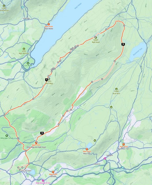
1) The route described starts near the village stores at Eskdale Green (but passes Miterdale Forestry Commission car park near its end, enabling this route description to be adapted for that alternative starting point). Look for the lane heading east besides the public toilet block and the adjoining woods named "Giggle Alley" on the Forestry Commission signpost.
 |
| Start the walk along this lane next to Giggle Alley woods |
2) You could just stick to the lane, but for a pleasant diversion, head through the first gap in the wall on the left, following a path directing you to the 'Japanese Garden' on a slate sign.
 |
| Follow the slate signs to the Japanese Garden |
3) The path heads back left, climbing above the village to arrive at the surprising ruins of a Japanese style garden, originally laid out in 1914. Sadly, it's now very unkempt, certainly by Japanese standards!
 |
| Walk into the woods beyond this little bridge in the garden |
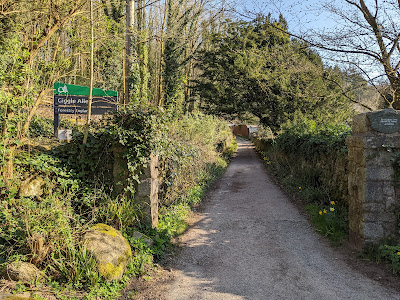
4) From the top of the garden, head through the woods on a path running through the trees parallel to the lane below. On your left you can see the rocky knoll of Great Bank, rising above the forested slopes that you will soon be walking through.
 |
| The knoll of Great Bank, with Whin Rigg in the distance |
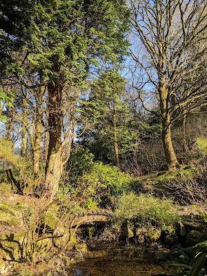
5) Stroll through the woods until you rejoin the original lane. Immediately afterwards, at a junction of old walled lanes, ignore the lane to your right and keep straight ahead.
 |
| Keep straight ahead at this junction of lanes |
6) The lane goes downhill until it reaches the tarmac road heading to the Miterdale Forestry Commission Car Park. Go straight across the lane to take the signposted bridleway to Irton Fell and Wasdale, which immediately crosses the River Mite on an arched stone bridge.
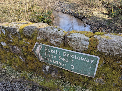 |
| Follow the bridleway across the river |
7) The old track takes you uphill through the forestry commission land. It crosses a forest road twice but, for both crossings, the old path is easy to make out on the other side of the track. |
| The first crossing of the forest road |
 |
| Heading up the old path after the second crossing of the forest road |
8) On the third occasion that you meet a forestry road, turn right to briefly walk on the road, then, after only thirty metres or so, leave the road on the path to the left.
 |
| Walk briefly along the road and then take the path on your left |
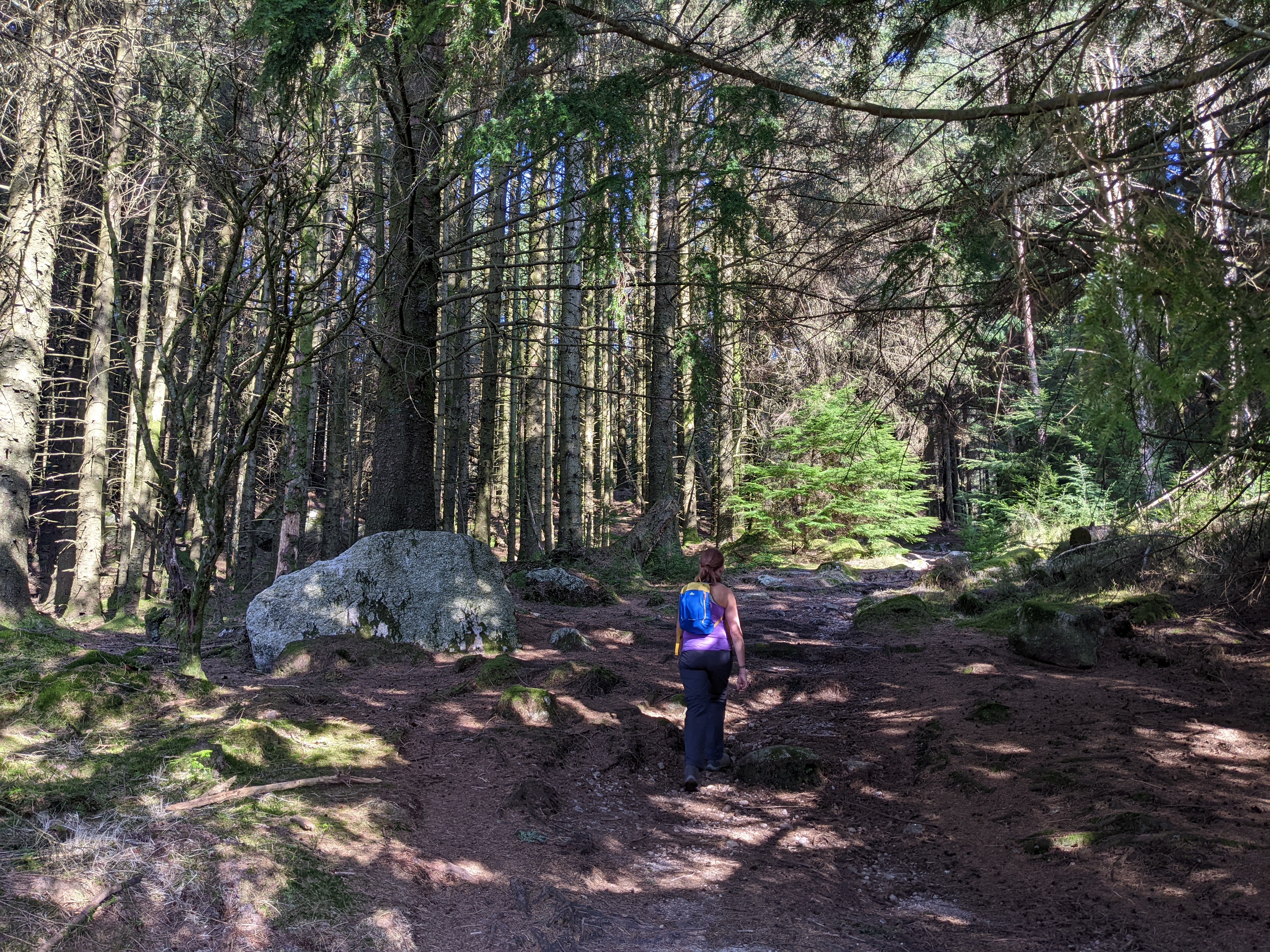
9) The route now takes you through an area of evergreen trees, in contrast to the deciduous trees you have generally walked through so far. (There has been a lot of felling on the higher slopes around Great Bank but these trees certainly still remained in 2022.)
 |
The path now takes you through tall pine trees (in 2022 at least!)
|
10) The path emerges out of the pine trees onto a forest road for the last time. The road heads east towards Great Bank. You should again cross the road onto the clear path ahead. This path now heads across open land with just the many greying tree stumps to show where woodland must have once stood.
 |
Cross the road and follow the path across the open land ahead of you.
|
11) After about ten minutes further walking, you'll reach a gate in the stone wall running along the top of the ridge. This is Irton Fell. To your left you will see the lowlands stretching down to the coast and, easily recognisable, the Sellafield complex. Ahead, you will get the first glimpses of Buckbarrow, Seatallan and the other Western Fells rising to the north of Wast Water.
 |
| Looking across the tree stumps down to the coast at Sellafield |
12) Go through the gate and turn right. The route is now easy to follow as it climbs the fell on a clear path running alongside the stone wall. However, the ground here can also be very wet and you are likely to have to pick your way carefully at times.
 |
| Go through the gate and turn right alongside the wall |
13) Continue alongside the wall and then go through a gate in a wall which now crosses the path, and then climb, still often boggily, on the path across the open ground beyond.
 |
Pick your way through boggy ground up to another gate
|
14) The path climbs to a grassy rise with a small cairn on its top. You will be able to see Whin Rigg rising ahead of you, beyond the top of the deep gully carved out by Greathall Gill.
 |
| Whin Rigg across the gully of Greathall Gill |
15) Walk around the top of the gully and continue on the cairned path up the grassy slope ahead.
 |
| Walk around the top of the Greathall Gill gully |
16) After about a twenty minute ascent, you will reach the top of Whin Rigg (1755'). The summit cairn is on a knoll to the right of the path.
 |
| The summit cairn on Whin Rigg |
17) However, this is definitely not a walk for just heading to the summit cairns to "bag the Wainwrights". Better views are to be had by walking to the knoll above the cliffs, to the left of the path, now topped by a stone wind shelter.
 |
| The wind shelter on the cliff top knoll of Whin Rigg |
18) Even better views, looking along Wast Water all the way to Yewbarrow, Kirk Fell and Great Gable, can be found just a few yards further along the cliff top.
 |
| Looking along Wast Water from the top of Whin Rigg |
19) Continuing on the thin path skirting along the cliff top, you will then cross the top of Great Gully, with the head of Wast Water and Wastwater Youth Hostel far below you.
 |
| Looking down into Great Gully |
20) Continuing around the cliff top, your next views are from the top of Broad Crag.
 |
| The views from above Broad Crag |
21) The main path to Illgill Head continues across the grass on the top of the fell, but set back from the cliff edge. It passes by a collection of small tarns that form in the slight depression between the two fells.
 |
| The main path continues across the grass after this tarn |
22) However, unless visibility is so poor that the views can't be seen (and that, of course, can be the case!) it has to be worth taking the time to keep following the thinner path along the clifftop, taking in the spectacular views out over Wast Water.
 |
| Try to avoid this walk on days like these! |
22) After Broad Crag, the next viewpoint is from above Bell Crag.
 |
| The Broken Rib arête from Bell Crag |
23) Perhaps the most spectacular views of all are from the top of the next section of cliffs. First, you can look down to the lake below along the arête of 'Broken Rib'.
 |
| Buckbarrow and the Broken Rib arête |
24) Just beyond 'Broken Rib' you can walk out onto a rock at the end of a slightly raised cliff edge. This is definitely a place to be photographed - but make sure you know where you are placing your feet at all times!
 |
| A viewpoint where it's worth making an appearance ... |
25) As you will see if you peer carefully over the edge from here, this is the part of the fellside which is the most heavily eroded. Below the cliff edge lie the huge slopes of debris that make up the Wastwater Screes.
 |
| The Wastwater Screes lie beneath this section of clifftop |
26) Rather disconcertingly, the grassland behind this section of cliffs is filled with deep grooves, evidence of the erosion that must still be inexorably taking place as the fellside shifts towards the scree slope. But put that thought out of your head (!) as you find one or two last viewpoints above the top of High Adam Crag.
 |
| Some final views above High Adam Crag |
27) Returning to the main path across the grass for the last part of the ascent to Illgill Head, you will reach a large cairn marking its lower, western, top. The outlines of Scafell and Scafell Pike loom behind the grassy plateau on top of the fell.
 |
| The cairn on the lower western top of Illgill Head |
28) Walk across the plateau to the slightly higher ground that marks the top of Illgill Head (1983'). Again, the small summit cairn lies on a slight rise to the right of the path but a much grander wind shelter stands on a rise a little further along the path, nearer the clifftop.
 |
| The wind shelter on the summit of Illgill Head |
29) The onward route now continues along the ridge in the direction of Scafell. At the end of the ridge, marked by a cairn of reddish stones, you can look down into Wasdale Head. The craggy sides of Yewbarrow look particularly impressive from here.
 |
| Wasdale Head from the end of the Illgill Head ridge |
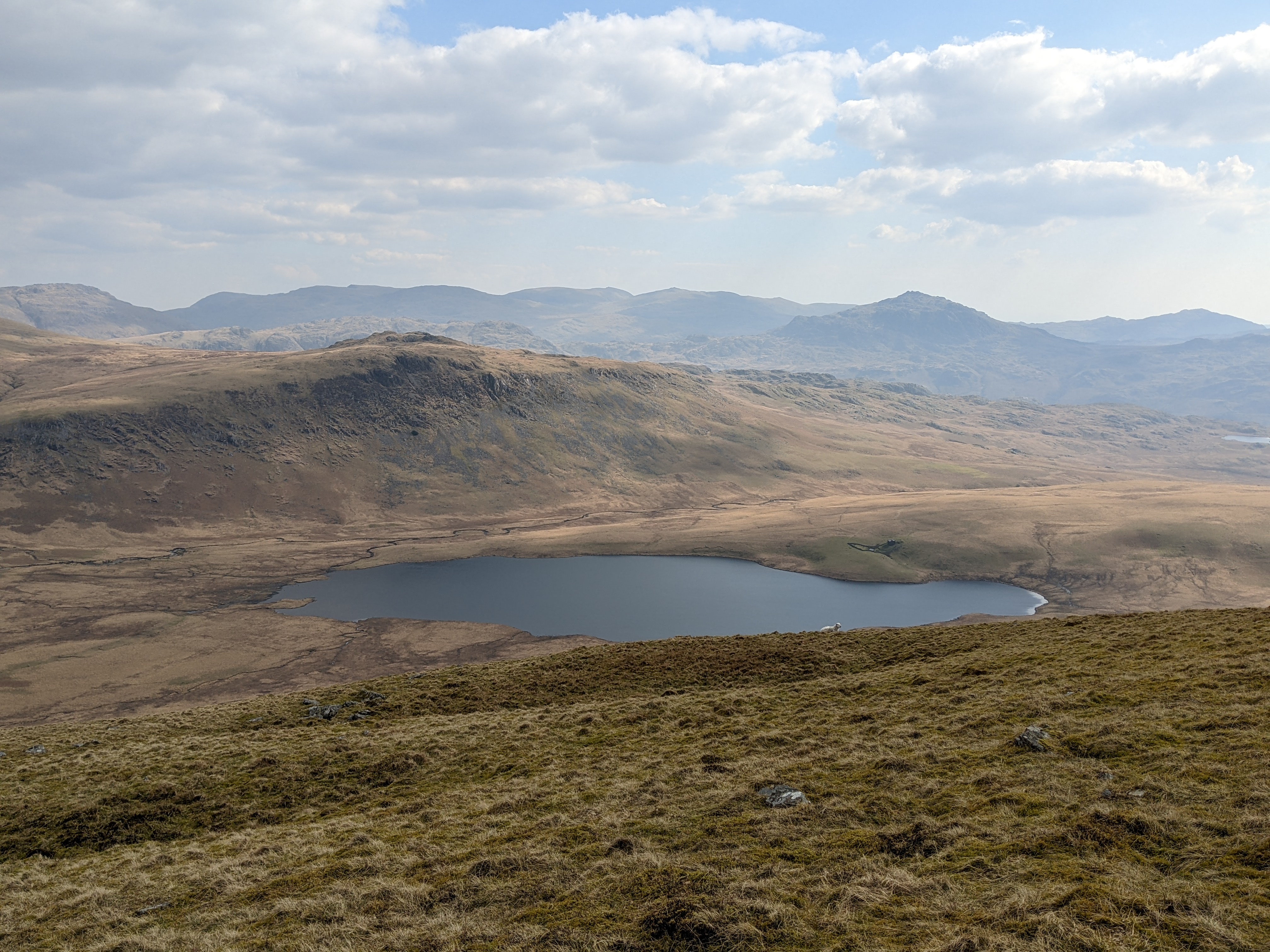
30) Look for the path that descends down the steep grassy slope roughly in the direction of Scafell. As you descend, you will see Burnmoor Tarn below you to your right.
 |
| Burnmoor Tarn will be down to your right |
31) The path turns towards Wasdale Head as it loses height down the fellside.
 |
| A view of Wasdale Head as you descend the fell |
32) After a sometimes slippery descent, the path brings you down to the area of moorland between Scafell and Illgill Head.
 |
| Scafell across the moorland below Illgill Head |
33) As you were descending, you may have been able to make out various paths crossing the moorland below. For the return route via Miterdale, don't go further onto the moorland but find the path that heads to the right, contouring above Burnmoor Tarn.
 |
| Follow the path that heads right, above Burntmoor Tarn |
34) Follow the path back above the tarn, around the south-east flank of Illgill Head
 |
| Scafell from the path above Burntmoor Tarn |
35) The path then reveals the hidden valley of Miterdale. Down to your left you will see its deep V-shaped valley as well as the crags at its head.
 |
| The head of the Miterdale valley below the path |
36) The path crosses several streams flowing into the valley from Illgill Head. It is these that provide the waters of the River Mite - not Burntmoor Tarn which empties to its east into a different valley altogether.
 |
| One of the streams flowing down from Illgill Head into Miterdale |
37) The path continues south-west above the valley on a fairly level course. There is no dramatic end to the ravine. Instead, the surrounding fellsides grow lower and the valley starts to opens out into woodland ahead of you.
38) After about 3km of walking from the bottom of Illgill Head, the path starts to emerge from the moorland scenery and a field appears to your right, on the other side of a stone wall. As this wall also has a barbed wire fence along it, in order to cross into the field it's important to head right, and slightly uphill, to find the gate into the field.
 |
| Follow the wall uphill to find this gate into the field |
39) Once successfully through this first gate, the way ahead is fairly obvious, going gently downhill along the middle of a grassy ridge through various gates and walls.
 |
| Head downhill along the middle of a grassy ridge |
40) You will end up on a wide stony track, passing the ruined buildings of Miterdale Head Farm, and then bringing you to a footbridge across a beck in front of the solidly built Bakerstead.
 |
| Walk down the old track at Miterdale Head ... |
 |
| ... and cross the footbridge at Bakerstead |
41) The building is marked on the OS map as an Outdoor Pursuits Centre but, sadly, no more. The windows are boarded up. The sign on the door says the centre is run by Wyndham School in Egremont. However, a school of that name no longer exists.
 |
| A sadly boarded up 'Outdoor Pursuits Centre' |
42) The track that continues down the valley is now in poor condition (certainly for anyone on wheels although it's fine for walkers) but its width suggests it must have once been of much greater importance.
 |
| Looking back along the track with Scafell in the distance |
 |
In case you're looking for the path to Eskdale
|
44) Your route continues through the farmland along the valley bottom.
 |
| The farm road continues along the valley |
45) The road crosses a bridge over the River Mite just before the Forestry Commission Car Park.
 |
The Miterdale Forestry Commission Car Park
|
46) The road, now with a tarmac surface, continues alongside the river. The reappearance of the rocky knoll of Great Bank, up to your right, will reassure you that it's now not too far to Eskdale Green.
 |
| Great Bank above the road from the car park |
46) Soon after, you will find yourself back at the point where you crossed the road to go over the old bridge at the start of the bridleway to Irton Fell. Turn left, and follow the lane back to Eskdale Green.
 |
| Turn left and follow the lane back to Eskdale Green |
Worth knowing: In the pages on Illgill Head, Wainwright's Walking Guide to the Southern Fells points out that the Wastwater Screes consist of stones lying on a slope at their maximum 'angle of rest', that is at about 35 - 40 degrees. That's not just true of the scree slopes above the waterline. The slopes continue down a further 250 feet or so to the bottom of Wast Water, which is the deepest lake in England.
 |
| Wastwater Screes at sunset |
Interestingly, while the surface of the lake is about 200 feet (60 m) above sea level, its bottom is over 50 feet (15 m) below sea level.
 |
| The stones lie on a slope of around 35-40 degrees |
Wainwright's Guide also gives directions for the path that can be taken along the side of the lake, making its way, sometimes over difficult rocky terrain, across the bottom of the Wastwater Screes.