THREE Wainwright circular walk: Bowfell, Esk Pike, Great End
Walk Rating:⭐⭐⭐⭐⭐
Time: 7 - 8 hours
Parking: At either Old or New Dungeon Ghyll car parks or, if you arrive early enough, there are some free roadside places by Rossett Bridge. Alternatively, take the 516 bus from Ambleside (although the timings may be tight).
 |
| Bowfell from Middle Fell Bridge, Old Dungeon Ghyll |
Only eleven of the 214 Wainwright Fells rise over 2900' in altitude. This walk takes you to the top of three of them, and the views from their summits, as you might expect, don't disappoint. Great End and, especially, Bowfell, have distinctive summit profiles when seen from a distance and, on this walk, you can see these mountains at close quarters.
However, this particular route has another reason to stick in the memory and that's the magnificent route it takes to the top of Bowfell by the so-called "Climber's Traverse". This is one of the most spectacular high-level routes in the Lake District that can be walked with relative ease (although vertigo sufferers might disagree). Find yourself a sunny dry day and walk this route!
 |
| Strava estimates a walking distance of 17km with around 1100m of elevation |
1. Walk beyond Old Dungeon Ghyll, to where the road turns sharply left in front of a red post box. Head through the gate next to the post box and follow the tarmac farm road that continues onwards through the field ahead.
 |
| Walk across the fields on the farm road towards "The Band" |
2. Follow the road across the well-watered fields at the end of the wide valley of Mickleden. The Langdale Pikes rise to the right of the valley. To the left, there is a sloping fell rising up towards Bowfell. This is "The Band", the ridge that you will be using as your route of ascent.
 |
| The Langdale Pikes rise to the right of Mickleden |
 |
"The Band" rises up to Bowfell on the left of Mickleden
|
3. The tarmac road crosses the Oxendale Beck before ending at Stool End Farm. Follow the public right of way through the farm, then, once beyond it, take the path on the right that leaves the valley to head up onto "The Band".
 |
| The Langdale Pikes on the other side of Mickleden |
4. Follow a clear path all the way up the ridge. For most of the way up, the route mainly offers views out over Oxendale, to your left. However, there are also places where there are excellent views out to your right, over Mickleden, to the Langdale Pikes. |
| The path levels out onto a grassy plateau |
5. The path starts to level out onto a grassy plateau at the top of the ridge. The summit of Bowfell now appears ahead. A large cairn clearly marks the route. However, as the main 'tourist path' soon starts to veer left, towards the 'Three Tarns' col, for the "Climber's Traverse" you now need to keep a look out for the less distinct path that forks right, heading to the other side of the peak ahead of you.
 |
On the path climbing up to the 'Climber's Traverse'
|
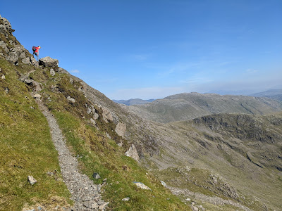
6. The path up the fellside is not always entirely clear but there are also remains of some old paved steps in places, indicating that perhaps this was once a more frequently used route. However, when you reach the top of the little ridge above, the Climber's Traverse path stretches clearly ahead of you, below the eastern crags of Bowfell.
 |
The 'Climber's Traverse' path will be clearly visible ahead of you
|
7. The name of the traverse should not put you off - it is a path used by climbers to reach the crags but it certainly does not require any mountaineering skills. In fact, so long as the magnificent, but perhaps slightly vertiginous, views down into the valley below don't trouble you, the way ahead under the rockface is very straightforward.  |
| Looking down towards Rossett Pike and Glaramara |
 |
| Continue ahead on the clear path |
 |
| The view back down Mickleden to the Langdale Pikes |
8. The traverse climbs to a small rise below Flat Crags.
 |
| The path climbs a small rise |
9. The path then descends slightly, continuing onwards beneath the towering crag above.
 |
| Walking below Flat Crags |
10. The route then gains height again, up to a little ledge at the bottom of Cambridge Crag. This spot can be clearly identified by the water trickling from the bottom of the cliff.
 |
| The water trickling from the bottom of Cambridge Crag |
11. Wait a while and take in the view and the isolated beauty of this secluded spot.
 |
| The Bowfell Buttress, across the scree gully from Cambridge Crag |
12. Don't try and continue up the scree gully between you and the 'Bowfell Buttress'. Instead, you now need to climb up to your left, along the near side of the Cambridge Crag. This might seem an unlikely prospect at first but actually provides a clear line of ascent.
 |
| Looking back down as you start the ascent |
13. The route skirts along the line of boulders to the side of Cambridge Crag. So long as this route remains relatively infrequently walked, the ascent should remain secure underfoot. As you pick your way upwards, don't forget to occasionally pause and take in the spectacular views behind you.
 |
| Looking back as you climb up alongside Cambridge Crag |
14. To your left, across the boulders, lies the smooth rock of Bowfell's "Great Slab". Don't try and walk up it - there would be very little to stop your fall if you slipped!
 |
| The route gives you a close-up view of the 'Great Slab' |
15. Continue gaining height to the right of the line of boulders until your reach the top of the Great Slab.
 |
| Higher on the climb up the line of boulders |
16. Your splendid isolation will probably also now end because the main 'tourist path' climbing from Three Tarns runs along the ridge just above the Slab as well.
 |
| At the top of the 'Great Slab' |
17. Now head up to the right, along this main path, to the summit of Bowfell, a distinctive rocky pyramid whose shape makes this one of the easier fells to identify from a distance.
 |
| From the Great Slab, take the clear path to the summit |
18. The summit of Bowfell (2960') provides tremendous panoramic views in all directions.
 |
| The Scafells and Mickledore from Bowfell |
 |
Crinkle Crags beyond the Three Tarns col
|
19. Leave the summit by making your way northwards to pick up the path running across the western side of the ridge, down to the 'Ore Gap' col. However, before you descend too far, it's definitely worth taking a slight detour to take in the views from the eastern, craggy side of the ridge.
 |
Looking down the gully into Mickleden
|
20. A particularly good viewpoint can be found by walking beyond the top of the scree gully to stand above the Bowfell Buttress. From here you can look across Cambridge Crag at the 'Great Slab', and see the route of your earlier traverse.
 |
| The 'Climber's Traverse' running beneath the 'Great Slab' |
21. Now turn away from these sheer drops and return to the cairned main path descending to the col at Ore Gap.
 |
| Descending to the Ore Gap, with Esk Pike ahead |
22. From the Ore Gap, paths head left, towards Eskdale, and right, down to Angle Tarn. However, our route continues on the obvious path up the slope ahead to the summit of Esk Pike (2903'). There is a good view over the upper reaches of Eskdale towards the Scafells and north-east, down into Langstrath.
 |
| The Scafells from Esk Pike |
23. Wainwright notes in his Walking Guide to the Southern Fells that the rocks on the top of Esk Pike differ from those on neighbouring peaks, being flakier and coloured with "brown or coppery hues with generous splashes of white". Some of those rocks have been used to make a tall cairn just below the summit rocks (in 2021 at least!)
 |
| On the summit of Esk Pike |
24. The path now descends to the north-west from Esk Pike, leading to the grassy col of Esk Hause.
 |
Walking down to Esk Hause
|
25. From Esk Hause follow the very clear path (as this is the route taken by walkers heading from here to Scafell Pike) heading west into 'Calf Cove', the little depression to the south of the summit of Great End.
 |
| Heading from Esk Hause towards Great End |
26. A slight detour to the right of the main path gives you some idea of the height of the tall cliff face on the northern side of the mountain, from which 'Great End' presumably earned its name. However, this northern face is best seen by making a much bigger detour down towards Sprinkling Tarn, beneath the cliffs, which is perhaps best kept for another day's walking.
 |
| Sprinkling Tarn, beneath the northern cliffs of Great End |
 |
| Great End from Sprinkling Tarn (on another day!) |
27. The main path takes you westwards out of Calf Cove, up onto the ridge that leads to Ill Crag. If you take this more defined path, having climbed to the ridge you can then double-back along the higher ground over to the top of Great End. You can save some time by cutting this corner and walking directly up the grassy slopes above Calf Cove. However, don't cut up too soon or you will be picking your way over a lot of rocks.
 |
| Looking down into Calf Cove with Esk Pike behind |
28. The summit of Great End (2984') is scattered with stones and has two separate cairns marking the two highest points.
 |
| At the summit of Great End (2984') |
29. However, the best views are not found from the summit cairns but by walking a little further, across the rocks, from where you can look northwards, down over the cliffs and gullies of the "Great End" itself.
 |
| Look down on Sprinkling Tarn, 900 feet below you |
 |
| A raven on the cliffs of Great End |
30. Now retrace your steps to Calf Cove and back to the col below. Wainwright stresses in his Walking Guide that the 'real' Esk Hause is this higher col between Esk Pike and Great End. The reddish soil underfoot comes from the haematite in the rocks in this part of the fells.
 |
| On Esk Hause, with Great End behind |
31. From the higher col, now walk downhill a few hundred metres, north-east in the direction of the ridge formed by Allen Crags and Glaramara. You will pass the cruciform wall shelter that lies just above the lower, 'alternative' Esk Hause. This pass carries the well-trodden path that goes underneath the cliffs of Great End, from Wasdale to Langdale.
 |
| Looking from the higher Esk Hause to the lower col below |
32. Turn right onto this lower main path and head downhill, south-east towards Angle Tarn. There will be good views on your left down into the top of the Langstrath valley and over some small tarns as you walk over Tongue Head. |
| Looking down into Langstrath |
 |
| Crossing Tongue Head |
33. A paved path drops down to Angle Tarn, crossing the Angletarn Gill emptying its waters down into Langstrath.
 |
| The path descends to Angle Tarn then rises to the Rossett Pass |
 |
| Crossing the Angletarn Gill |
34. The path then continues onwards, rising from Angle Tarn to the Rossett Pass above, the col sitting between Rossett Pike on the left and Bowfell on the right.
 |
| Looking back from Rossett Pass on the route from Esk Hause |
35. As you walk over the pass, you can look up at the Great Slab above you on the right and wonder how the Climber's Traverse seems possible from this angle!
 |
| The Great Slab glinting in the sunlight above Rossett Pass |
36. The rest of the walk is a bit of a test of tired legs as you walk down the winding path that first heads right, away from Rossett Gill, and then turns to descend alongside it. However, there are great views across to the Langdale Pikes and along Mickleden to liven up what can be a rather tiresome descent.
 |
| The long descent down the valley of the Rossett Gill |
37. After a long walk, your legs will be glad when you arrive in the valley bottom. The path crosses the Stake Gill over a flat footbridge, and then makes its way back to Old Dungeon Ghyll on a clear track that runs alongside the Mickleden Beck.
 |
Follow the track down the valley alongside Mickleden Beck
|
38. There are some final excellent views to be had of the Langdale Pikes, before the track brings you out behind Middle Fell Farm and the Old Dungeon Ghyll Hotel.
 |
| Take in some final views of the Langdale Pikes |
Worth knowing: When you started the walk by heading through a gate, where the main road turned left in front of a postbox, you could have instead turned right over an arched stone bridge leading to a field next to Middle Fell Farm.
 |
| Middle Fell Bridge |
 |
| Middle Fell Bridge from Old Dungeon Ghyll Bridge |
Fans of the film should definitely visit the train station in Carnforth, a town just down the M6 to the south of Lakeland. The station was used as the location for shooting much of the film.
 |
| Modern trains and old memorabilia on Platform One |
The Heritage Centre on the central Platform 1 displays both film and railway memorabilia, and even includes a mini cinema where you can watch 'Brief Encounter' before having refreshments in the adjoining Refreshment Room.
 |
| Watch 'Brief Encounter' in the Heritage Centre |


