Green Crag and Harter Fell
TWO WAINWRIGHT circular walk: Green Crag and Harter Fell (Eskdale)
Walk Rating:⭐⭐⭐
Time: 4 - 5 hours
Parking: limited free spaces in the small car park on the roadside opposite Wha House Farm (Grid Ref: NY 200 009) or at the Woolpack Inn (Grid Ref: NY 190 010)
 |
| Harter Fell from across the top of Eskdale |
Green Crag and Harter Fell stand close to each other on the high ground between the Duddon valley and Eskdale, although they can be most easily reached from the latter, as is described in the route below.
A walk to both peaks takes you across some beautiful countryside (although the lower ground between them can get a little marshy). Green Crag, in particular, is indeed 'green'. However, while both fells offer rocky summit outcrops, it is Harter Fell that provides the real 'crag' to climb to reach its highest point!
 |
| Strava estimates a walking distance of 12km |
1. Starting from the Woolpack Inn, take the track down to the riverside and cross over the stone arched 'Doctor Bridge' to take the track on the far side of the River Esk to Low Birker Farm. From there, follow the path that goes left, behind the farm and then starts to zig-zag up the hillside, following the course of the old 'peat road'.
2. The old peat road passes the distinctive shell of an old stone building, very likely one of the 'peat huts' used to store the peat that was once brought down from further up the fellside.
3. At the top of the slope, the path turns left along the ridge, towards the summit of Green Crag, skirting above the marshy ground around Low Birker Tarn.
 |
| Walk across the higher ground above Low Birker Tarn |
5. From this col, turn right and find the path that takes you up through the rocks to the top of Green Crag.
6. The summit (1602') has a small cairn marking its highest point from which you can look out to the ridge of peaks from Scafell to Bowfell.
7. Looking to the left of Scafell, and a little further distant, you should be able to pick out Pillar and its neighbours around the Mosedale Horseshoe.
8. To proceed towards Harter Fell, descend the summit on its eastern side back towards the col. Then head downhill, aiming for a point just to the left of the plantation of trees growing in the depression between the two fells.
9. The last few hundred metres at the bottom of the slope may be a little marshy but you should be able to pick a route that brings you out on the bridleway running along the foot of Harter Fell, without too much difficulty.
10. Now cross the bridleway and head straight up the steep slope ahead until you reach the rocky summit of Harter Fell (2140').
11. The top of Harter Fell is an interesting place. A number of craggy outcrops rise up from the summit area, at least one certainly standing taller than the rocks where a triangulation column has been built. With a bit of exploring around the tallest outcrop, you should find a way to climb up to the true summit.
12. As with Green Crag, there are good views north towards the Scafells, but now you can also spot the Roman fort guarding the Hardknott pass in the foreground.
13. To return to Eskdale, descend north-west through a gap in the rocks at the top of the fell, down towards the gentler slopes overlooking the green valley below.
14. Where the path meets the Spothow Gill, the stream draining the marshy land between Green Crag and Harter Fell, you have a choice of routes. For a shorter route, cross the gill and find a path heading left, across the lower flank of Green Crag, back to Doctor Bridge. For a longer route, bear right on a clear path, and head down through the bracken to cross the river at Jubilee Bridge.
15. The path crosses the bridge and brings you out at a car parking area at the western end of the Hardknott pass. Turn left and return to wherever you parked your car by walking back along the road, towards Wha House Farm.
 |
| The phone box near Jubilee Bridge has seen better days! |
Worth knowing: Eskdale and the area to the south and west of Green Crag and Harter Fell is well worth exploring, even if Wainwright decided that most of it lay outside the area that would be covered by his Walking Guides.
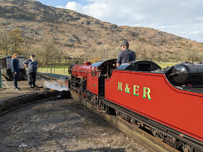
A little further down Eskdale from the Woolpack Inn, the 'La'al Ratty' narrow-gauge railway has its terminus at Dalegarth.
From here, steam trains take passengers along the seven-mile journey to the historic port of Ravenglass, once Roman Glannoventa. Their train whistles can often be heard from the surrounding fells!
You can walk from the station to find the ruins of an old bath house, once belonging to the 2nd-century Roman fort that protected the harbour on the estuary.
Closer at hand, and lying to the east of Green Crag and Harter Fell, lies the valley of the Duddon, a relaxing spot for sitting by, or in, the river on a hot summer's day.


